Executive Summary
The purpose of the Lower Nicola River Watershed Connectivity Restoration Plan (WCRP) is to improve understanding of habitat connectivity for Chinook Salmon (Onchorhunchus tschawystcha), Coho Salmon (O. kisutch) and steelhead (O. mykiss) (herein referred to as Pacific salmon and steelhead) in the Lower Nicola River watershed and inform efforts to close knowledge gaps and plan and prioritize restoration. The lands and waters that form the basis of this plan are the traditional unceded territory of the Nlaka’pamux/Scw’exmx and Syilx peoples.
Local data and knowledge are combined with connectivity modelling to estimate current connectivity status and identify structures that potentially block the most habitat. This informs the prioritization of field assessments to close the most significant knowledge gaps efficiently. Information from field assessments of barrier status and habitat condition are incorporated into the model, improving understanding of which barriers block the most habitat, and informing restoration prioritization. As knowledge gaps are closed and barriers are addressed, this plan will be revised to summarize progress and provide updated estimates of connectivity status and the status and relative importance of remaining structures.
In the Lower Nicola River watershed, 377.18 km of spawning habitat are currently connected to the ocean and 5.47 km are disconnected from it. This means that 98.6% of the 382.64 km of total habitat is connected. 397.28 km of rearing habitat are currently connected to the ocean and 15.05 km are disconnected from it. This means that 96.4% of the 412.33 km of total habitat is connected.
In the Lower Nicola River watershed, 18 structures potentially disconnect spawning habitat. Of these, 2 are identified as barriers in need of rehabilitation (priority barriers), 2 are identified as barriers that do not warrant rehabilitation (non-actionable), and 14 require further field assessment. 25 structures potentially disconnect rearing habitat. Of these, 2 are identified as barriers in need of rehabilitation (priority barriers), 5 are identified as barriers that do not warrant rehabilitation (non-actionable), and 18 require further field assessment.
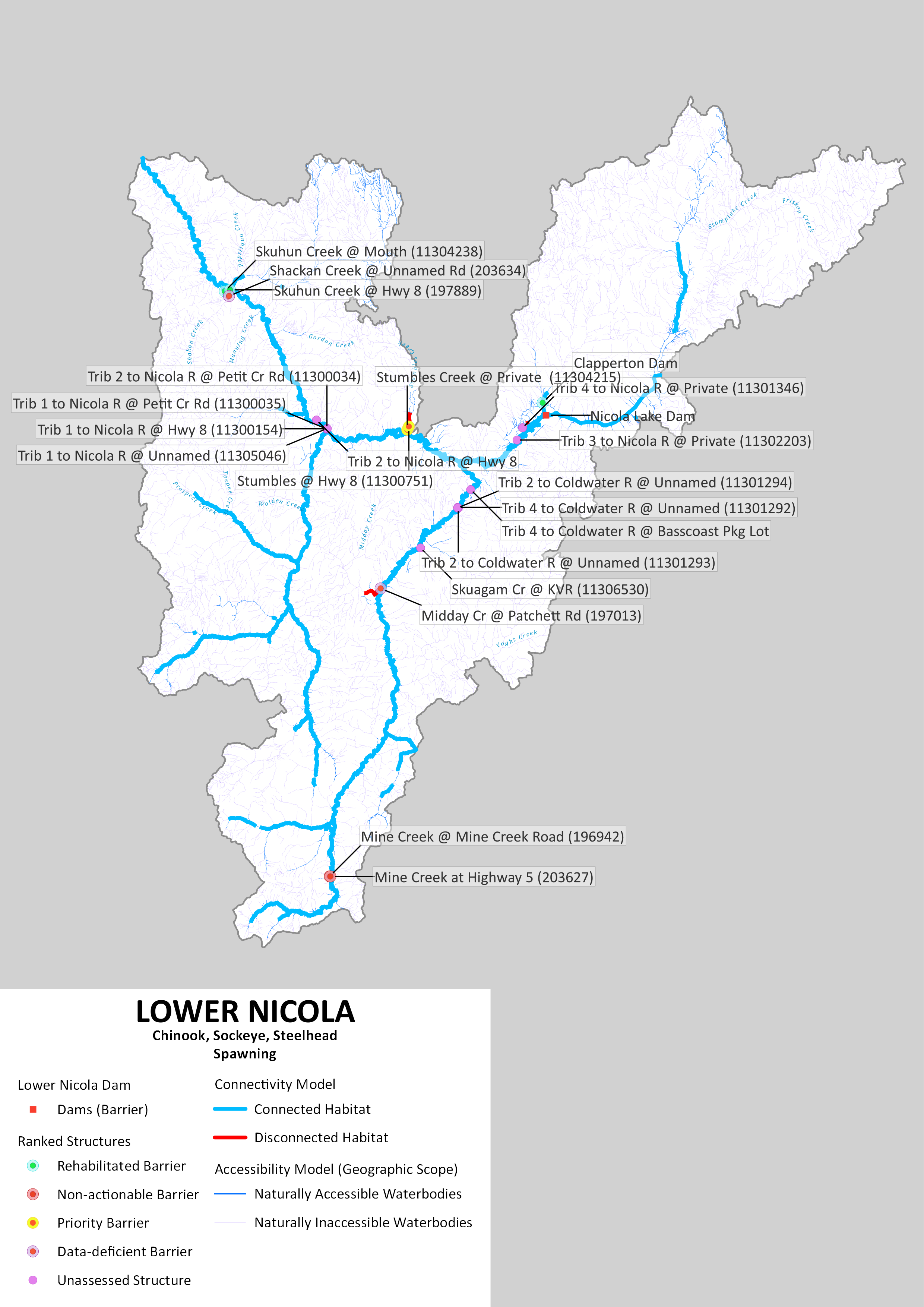
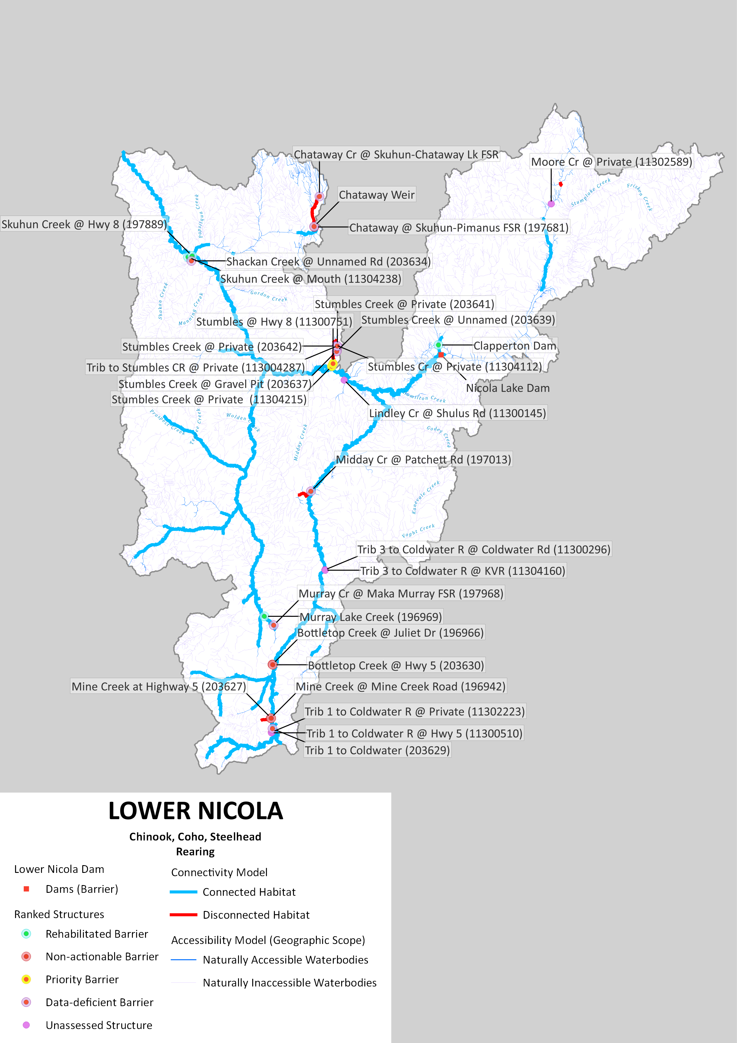
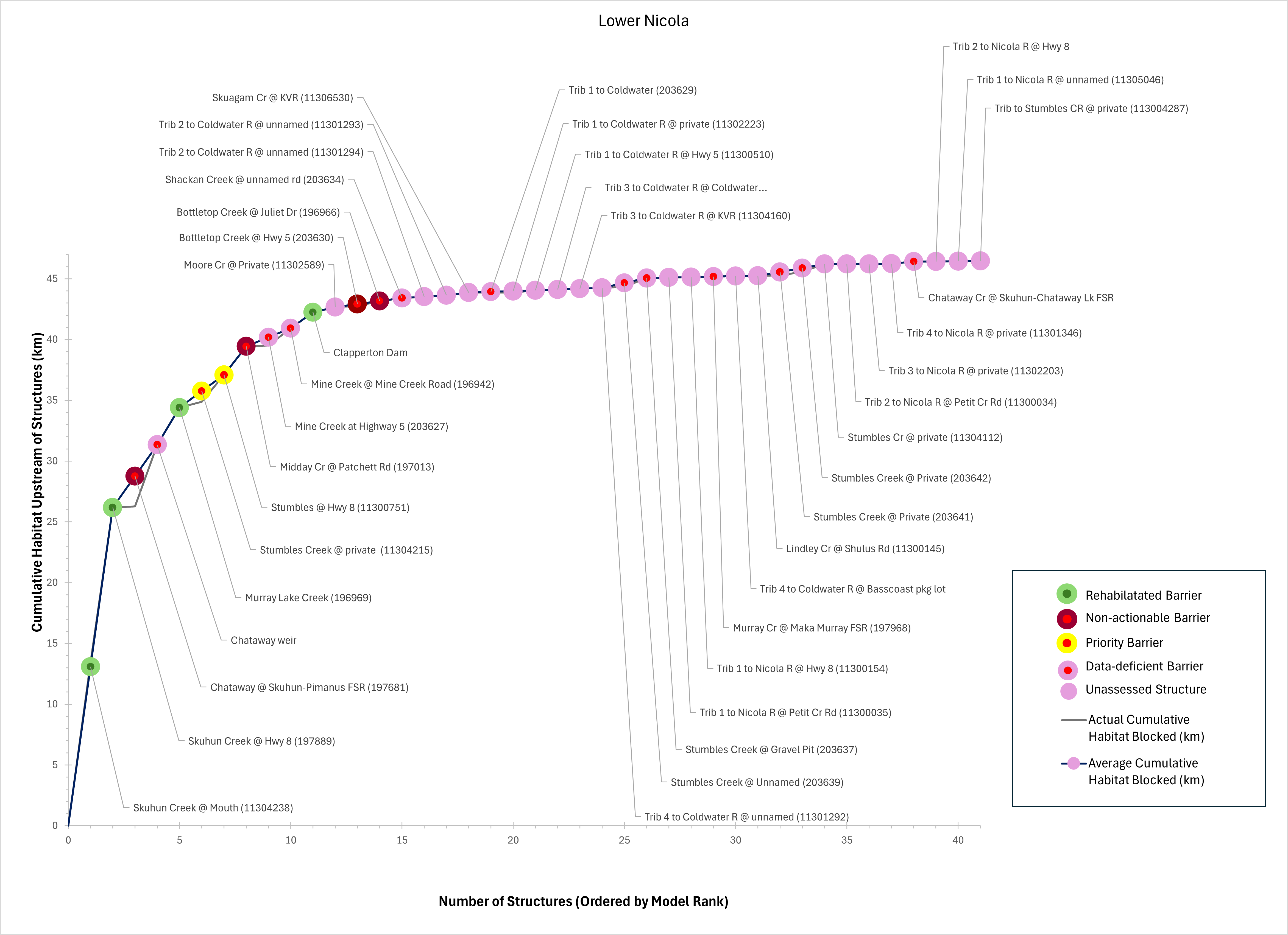
This WCRP was initiated in 2020 with a series of workshops completed with local partners and rightsholders, and the first version of this WCRP was published in 2021. Since inception, the passability of 67 structures has been assessed, and further habitat assessments were completed at 4 of these. Fish passage has been rehabilitated at 4 barriers: Skuhun Creek mouth and Highway 8 crossings, Clapperton Creek dam, and Murray Lake Creek at Maka-Murray/Maka-Michael FSR junction. This has resulted in improved or restored access to 19.86 km of habitat. Some lateral habitat and thermal refugia investigations were also completed as part of this WCRP process; however, other groups active in the Lower Nicola have both pioneered and advanced this work beyond what was completed and reported upon here.